This can be a rare treat for Mountain Views readers, but can we invite you to ‘ya hill walking tale about nothing other than a good local adventure!
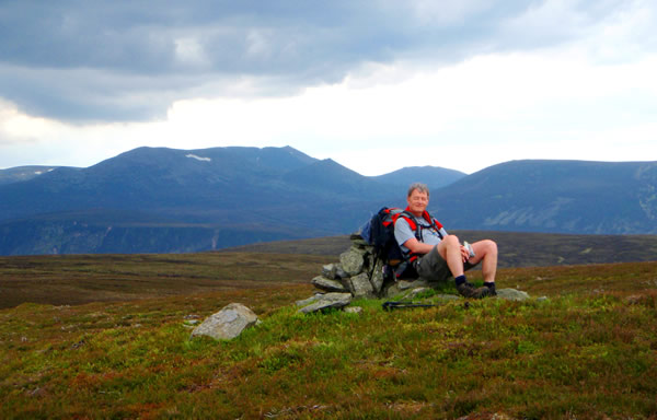
In contemplative moments I’ve always been fascinated by the satellite image of the Grampian Mountains that hangs in my bathroom. It shows that the hills are generally bordered on the east by wide coastal plains but they stretch out a long, gnarled finger which reaches the North Sea at my home town of Stonehaven. I had hatched a plan, with Andy and Alistair, to walk the crest of this finger of hills from the Glenshee Ski Centre car park to Stonehaven, largely following the southern watershed boundary of the River Dee. This route would take in seven Munros and a Corbett, some 4250m of ascent in 102km, including Glas Moal, Cairn of Claise, Tolmount, the Lochnagar range and Mount Keen and all in four and half days.
In, fact, when we chose to undertake this backpacking adventure in the first week of June it was in lieu of plan A which was to have been our umpteenth attempt at the Cuillin Ridge in one continuous scramble. But Andy had to call off because of a family bereavement and the Cuillin is so much a part of our annual, almost ritual, planning for us three musketeers that we could not contemplate going to Skye without him. So we rolled out this alternative plan and were blessed with a great few days of good weather.
Bribed by a bar lunch Andy drove us to Glenshee and promised to meet us at
the other end, hopefully when we walked, rather than crawled, into the Marine
Hotel at Stonehaven harbour four and half days later. Alistair and I were in
positive mood after a good lunch on a warm and sunny afternoon, but brought
back to earth when we hoisted the 40lb packs and felt that familiar strain on
the shoulders. We hauled up onto Glas Maol initially via the far from pretty,
ski service road which thankfully gave way to good hill paths to the summit.
The reward was a grandstand view of the snow patched Cairngorms to our immediate
north, the Ben Lawers hills on our southwestern horizon and to the east the
Grampians rolled on in hazy grey waves towards the sea 100km away. Visiting
day climbers wished us well on our journey as we moved off north east, crossing
the Monega path to Cairn of Claise and over easy ground to Tolmount. It’s
always amazing how the Scottish hills just seem to absorb hillwalkers and leave
you feeling you’re the only one there. So it was all the way over Fafernie
and to our camp on an island in the braided burn draining the col between Cam
t-Sagairts’s Mor and Beag. This was a superb vantage point, at 930m with
a view straight down the glen to the Dubh Loch, where I once stumbled across
a live wartime mortar bomb and became famous in certain tabloids as the saviour
of Princess Diana! We watched the sunlight and shadows lazily drifting across
the hills late into the evening.
In this first week of June we had hardly any darkness and were up early. Alistair complained that the running water on both sides had made him get up twice in the night and I shook out the crick in my back caused by an irritating tussock under my mat. Our lightweight breakfast of instant porridge and tea prepared us for our day’s hike of 20km, first over the easy Munro of Cam a’ Choire Bhoidheach and then upto the 1155m summit of Cac Cam Beag on Lochnagar. I remember once seeing The Cheviot from here on a clear winter’s day, 100 miles away on the English border but today we gazed into the east and could see Mount Keen, Mount Battock and in the far distance our penultimate hill, Clachnaben, with its characteristic granite tor.
Descending Jacob’s Ladder I was full of admiration for the clever alignment of boulders to form a resilient and camouflaged path although its continuation as a paved way across the lower heath was a little more obvious. We took some lunch, oatcakes and cheese, at the Glen Muick Visitor Centre before crossing over the track and heading up the Allt Darrarie gorge on a good path. A few kilometres later though we left this path to gain the watershed hills leading north and then east. I don’t think either of us had realised what difficult terrain this would turn out to be; a pathless bog, riven with peat hags, dotted with pools and stretching for a good 12km all the way to Mount Keen. Luckily for us it was quite dry and we could thread our way along the hags to make progress. We found a surprisingly pleasant campsite on the banks of the Burn of Fasheilach at about 680m where the stream occasionally surfaced from the depths of the peat and watched the sun go down as we ate our rehydrated dinner. The local red deer were rather astonished but fascinated by our presence amongst them. They stood their ground too until I put my walking poles to my head to imitate huge antlers and this was just too much for them; they scattered!
Our third day was a long haul over the peat bog to Mount Keen which never seemed to move closer until we were almost on it. We went straight up its steep western slope on our first path for many kilometres; over the summit and down the other side. Unfortunately, I tripped on a rock on this steep descent and as I stumbled my centre of gravity suddenly became lower than that of my big pack causing it to go completely over my head. Alistair helped me up and, testing a strained ankle, I limped on my way. The undulating ridge of heathery hills now on our easterly route proved much easier going and we kept up a good pace, over Braid Cairn, the strangely named Naked Hill, Hill of Gairney, Cock Cairn and Hill of Cat before crossing the ancient drove roads of the Fungle and Firmounth. By now there was a stiff northeasterly breeze lowering temperatures considerably and bringing a blanket of mist over these summits. For quite a while we tracked alongside an extensive double electric fence, apparently to separate the deer stalking on one side from the grouse shooting on the other. The fence continued over Mudlee Bracks and Hill of Cammie and then we diverted into upper Glen Tennet looking for a couple of elusive flat spots to camp. After 23 kilometres and 912 metres of ascent since our last camp we were ready for our three course meal of soup, pasta and custard!
We were not particularly looking forward to the steep 300m haul up the western slopes of Mount Battock from a standing start the following morning but by now we had emerged from our rusty shells and were on the Corbett’s 778m summit in 30 minutes. After a bizarre phone conversation with an office worker at his desk in London, who was enthralled that he had called someone on a long-distance walk in the Scottish Highlands, we resumed our course. On this side of the hill we were on familiar ground and well-frequented home territory, some 40km from the North Sea coast. We picked up the track arrowing eastwards, passing through an eerily strange landscape of eroded blanket bog and isolated towers of dry peat. We also came onto a long section of track newly resurfaced with bright, orange sand all the way into Glen Dye — some estates really do not give much thought to the appearance of the landscape they manage for the nation. A quick lunch stop at the Clachnaben tor, a mass of piled up granite blocks, then we descended the well maintained path to Robbers Copse in the glen below. Skirting the top edge of the wood I recalled how a few years ago, returning from the hill on a dark winters evening, I had skidded on a wet log in this spot and badly strained my ankle. As the pain subsided and I realised I could walk after all I phoned my wife, Janet, to tell her of my problem but that I was on my way home. Caringly, she responded, “well your dinner’s not ready yet anyway so don’t hurry!”
Crossing the River Dye was not the simple operation Alistair had bargained for; the estate keeper we met told us the marked bridge was down so we ended up rock-hopping, not so easy with big packs. It turned out we had been deliberately misled on this fact but then we were obviously just a nuisance for him. Then followed a long, grinding plod over deep, pathless heather to the twin tops of Kerloch Hill; the last substantial hill of our journey. We dropped down into Fetteresso Forest and shortly afterwards camped by the Sheeoch Burn surrounded by dense stands of Sitka Spruce. This was a rather primeval campsite in the gloaming; compounded by a cacophony of birds that kept up their chatter all night.
Alistair and I were always on the look out for ticks, especially since one of my work colleagues had recently contracted a pretty bad case of Lyme Disease. Any itch in the night was a phantom tick but Alistair had a lot to think about because next morning he realised he had camped right on top of an ant’s nest! So our final day was a 22km trek through the forest on tracks we knew pretty well from running and cycling routes. We planned to finish with a pint at Stonehaven Harbour around 1600 but then realised that if we pushed on hard we might make a bar-lunch! In fact, it took us just over 4 hours to reach the edge of the forest at Cheyne Hill and finally start walking a section of tarmac road only 4 km from the sea.
From here the view over Stonehaven and its bay is just magnificent; the new town enveloping the old harbour with sheer cliffs and a blue sea beyond. Andy met us a few kilometres out of town and we walked to the harbour together; arriving at 1330. So in fact we made the trip in just three whole days and two half days. In each of the first half day and subsequent three days we ascended over 900m, leaving just 535m for the last push through the forest. There was no better way to finish this long walk over the Grampian hills than sitting outside the Marine Hotel enjoying a pint in the sunshine and gazing over the yacht-filled harbour to the rolling surf.
Roger Owen
Please let the webmaster know if there are problems with viewing these pages or with the links they contain.